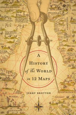
A History of the World in Twelve Maps
- By Jerry Brotton
- Viking
- 521 pp.
- Reviewed by Paul J. McCarren
- January 6, 2014
A British cartographic expert examines the centuries-long human urge to answer the basic question: Where am I?
Jerry Brotton’s History of the World in Twelve Maps is a response to the question, Where in the world am I? Or, as Brotton puts it: “The urge to map is a basic, enduring human instinct. Where would we be without maps?” His 12-part answer to that question isn’t so much a history of the world as it is the story of how humans of every age have tried to create a clear picture of what surrounds us, from the image of the world in Homer’s description of the design on Achilles’ shield, in the eighth century B.C., to the eye-catching work of Google Earth. These attempts, like all others, have failed. Or, in Brotton’s words, “There is simply no such thing as an accurate map of the world, and there never will be.”
There, I’ve given away the end of the story. But readers will be interested in following the steps leading to that. Brotton, chair of the Queen Mary University of London and presenter of the BBC series “Maps: Power, Plunder, and Possessions” adds to the pleasure of the journey with many crisp, black-and-white figures of maps and more than 50 dazzling color illustrations—although, by omitting notes in the text such as “See Figure 3,” he forces you to flip back to the “List of Figures” and “List of Illustrations” to see if they include a particular map mentioned in his narrative. (A nuisance, but not as arduous a task as wracking your brain to recall the meaning of the mathematical terms the author charmingly assumes readers will know as they move through his first chapter, “Science.”)
Brotton starts each chapter with a story to pique our curiosity: What inspired Roger II, the 12-century king of Sicily, to call for a summary (with maps) of the whole known world? Why did Martin Waldseemüller, an early-16th-century German mapmaker, label a recently discovered territory in the western Atlantic “America”? What made it possible for the Cassini family in mid-17-century France to believe they could create an accurate survey of the entire country? These are attention-grabbers for what we expect to be gripping tales.
However, after setting vivid opening scenes, Brotton often introduces arrays of secondary characters in brief references that resemble the Bible’s “begats.” For instance, while telling us how the English academic George Mackinder created the field of geopolitics to describe how “landscape, climate, and environment acted upon and shaped human life,” he adds that Mackinder was influenced by “George Curzon (1859-1925), the future viceroy of India and Foreign Secretary, and Alfred Milner (1854-1925), who subsequently became High Commissioner for South Africa during the Boer War ... [and was also] influenced by Henry Mosely (1844-91), the Linacre Chair of Comparative Anatomy. Mosely had participated in ... “ The list goes on.
For readers who might want to learn more about the people Brotton mentions in passing, references in a 45-page section of endnotes offer other works to read. But I often found the author’s scholarly thoroughness distracting. I kept wondering how much he expected me to know about the larger historical settings for his stories, and found myself having to turn to the Index so I could reread how a particular person was related to Brotton’s main point and basic question: What drives us to know where we are?
It’s a question worth asking, and readers patient enough to wait for an answer to emerge will be rewarded by sticking with Brotton’s cluttered narrative. Despite occasional blizzards of distracting names, he does build a clear and persuasive thesis: People in power (both yesterday’s monarchs of empires and today’s manipulators of markets) want a clear picture of the places over which they imagine themselves masters — they want visual confirmation that their influence extends as far as they claim. Such confirmation bolsters both their pride and their power.
Power, of course, costs money, and Brotton demonstrates again and again that map making has always been both a scientific and a financial enterprise. Two of his chapters, “Money” and “Information, Google Earth,” make the point at length. In “Money,” Brotton describes how new discoveries pushed back the world’s margins and opened up all sorts of commercial possibilities — so many, in fact, that a new commercial class kept expanding to exploit them. Businesses began to be as powerful in shaping nations as governments: “A new world was being defined by new ways of making money.”
In “Google Earth,” Brotton starts by citing part of Google’s mission statement: “You can make money without doing evil.” And anyone who perseveres through the array of acronyms Brotton uses to chart the story of Google’s rise won’t be surprised to find him focusing on the conflict between the self-interested commercial use of maps and the impartial scientific production of them: “It seems unlikely that [Google] can balance its aspirations for enormous profitability alongside its ostensibly democratic ideals.”
Brotton nicely sums up the constant tension between our instinctive desire to picture what’s around us and the impossible dream of making that picture perfect: “The paradox is that we can never know the world without a map, nor definitively represent it with one.”
Paul McCarren is a Jesuit priest writing Simple Guides to the Bible. He does pastoral ministry at St. Ignatius Church, at Chapel Point, and Loyola Retreat House, in Faulkner, both in southern Maryland.